
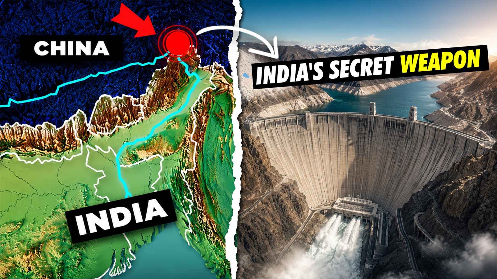
Yogesh sharma – The Brahmaputra is no longer just one of Asia’s great rivers. It is increasingly becoming a major geopolitical and strategic issue between China and India.
Originating on the Tibetan Plateau, the river flows through China, enters India’s Arunachal Pradesh as the Siang, and later becomes the Brahmaputra in Assam before flowing into Bangladesh.
What has brought renewed attention to the river is China’s plan to develop a massive hydropower project on the lower reaches of the Yarlung Tsangpo. With a proposed installed capacity of around 60 GW, the project could become the largest hydroelectric project in the world if completed.
For India, the development has raised questions about downstream water security, flood management, environmental impacts and the strategic importance of the Brahmaputra basin.
The Yarlung Tsangpo: From Tibet to the Brahmaputra
The river begins on the Tibetan Plateau, one of the world’s highest and most important high-altitude regions.
Known in Tibet as the Yarlung Tsangpo, the river travels across southern Tibet before reaching the region near Mount Namcha Barwa. Here, the river makes a dramatic turn known as the Great Bend and cuts through one of the world’s deepest and most spectacular river gorges.
The region has an extraordinary elevation difference, creating enormous potential for hydropower generation.
After leaving China, the river enters Arunachal Pradesh, where it is known as the Siang. It later meets the Dibang and Lohit rivers before becoming the Brahmaputra in Assam.
Further downstream, the river enters Bangladesh, where it is known as the Jamuna.
This makes the Brahmaputra a truly transboundary river system, with developments in one country having the potential to create concerns in countries downstream.
China’s Hydropower Development on the Yarlung Tsangpo
For decades, the difficult geography of Tibet limited large-scale infrastructure development in the Yarlung Tsangpo basin.
That began changing as China expanded roads, railways, transmission infrastructure and hydropower facilities across Tibet.
One of the important milestones was the Zangmu Hydropower Station, which became operational in 2015 with an installed capacity of about 510 MW. It was the first major hydropower station constructed on the main course of the Yarlung Tsangpo.
China subsequently developed additional hydropower projects as part of a broader cascade-development approach.
Instead of relying on a single dam, cascade development involves constructing multiple hydropower stations along a river system, allowing electricity to be generated at several locations.
But the biggest proposal came later.
China announced plans for a massive hydropower complex in the lower Yarlung Tsangpo region, close to the Great Bend. The project is commonly described as having a proposed installed capacity of around 60 GW.
If completed at the planned scale, it would surpass the Three Gorges Dam in installed generating capacity and could become the world’s largest hydropower project.
Why the Location Matters
The extraordinary hydropower potential of the project is largely linked to the geography of the Great Bend.
The Yarlung Tsangpo encounters an enormous elevation drop as it passes around the Namcha Barwa region.
For engineers, this combination of high water flow and steep elevation difference creates an exceptionally valuable hydropower resource.
For India, however, the location is strategically sensitive.
The project is being planned upstream of the point where the river enters Arunachal Pradesh.
This means China is located upstream while India and Bangladesh are downstream.
That geographical reality does not mean China can simply “switch off” the Brahmaputra.
The river receives substantial additional water from rainfall, snowmelt and tributaries after entering India.
However, being upstream gives China an important advantage in terms of monitoring, developing infrastructure and managing water resources within its territory.
That is why the proposed project has attracted significant attention in India.
India’s Proposed Response: The Siang Upper Multipurpose Project
While China is moving ahead with its Yarlung Tsangpo project, India has also been examining ways to strengthen its infrastructure in the Siang basin.
One of the most ambitious proposals is the Siang Upper Multipurpose Project (SUMP) in Arunachal Pradesh.
The project has been proposed with an installed capacity of around 11 GW, potentially making it one of India’s largest hydropower projects.
Unlike a conventional power project designed primarily for electricity generation, the proposed SUMP has a much broader objective.
Its potential functions include:
- Large-scale hydropower generation
- Water storage and regulation
- Improved flood-management capability
- Greater flexibility in managing downstream water flows
- Strengthening infrastructure in a strategically important border region
The project has therefore attracted attention not only from the energy sector but also from strategic and water-resource planners.
However, it is important to understand that a large dam cannot control the entire Brahmaputra.
The purpose of such infrastructure would be to provide India with greater ability to manage the portion of the river within its territory, rather than giving India complete control over the river system.
The Engineering Challenge
Building a mega hydropower project in the Eastern Himalayas is an enormous engineering challenge.
The region is geologically young, mountainous and highly seismically active.
The area falls within India’s highest seismic-risk classification, making earthquake-resistant design a major consideration for any large infrastructure project.
The history of the region also demonstrates the scale of the risk.
The 1950 Assam–Tibet earthquake, estimated at magnitude 8.6, caused massive landslides and river blockages across the region. Some temporary natural dams later failed, contributing to severe flooding downstream.
For engineers planning large reservoirs and dams in this environment, such events are more than historical incidents. They are critical considerations in designing foundations, tunnels, spillways and other structures.
Sediment: Another Major Problem
The Brahmaputra system carries enormous quantities of sediment from the Himalayas.
This sediment is a natural part of the river system, but it creates serious challenges for large reservoirs.
Over time, sediment can reduce reservoir storage capacity and increase maintenance requirements. It can also affect turbines and other components of hydropower infrastructure.
Any mega project in the Siang basin would therefore require sophisticated sediment-management systems, geological monitoring and long-term reservoir planning.
The difficult terrain also presents another challenge.
Before construction of a major dam can begin, extensive roads, bridges, tunnels, transmission infrastructure, worker facilities and other supporting infrastructure may have to be developed.
In many cases, building the infrastructure required to reach a remote Himalayan project site can itself become a massive engineering undertaking.
The Human Cost
Engineering is only one part of the debate.
The proposed project area is home to indigenous communities whose history and culture are deeply connected with the Siang River.
Among the important communities in the region are the Adi and Galo peoples.
For these communities, the river is much more than a source of water. It is connected to agriculture, forests, traditional practices, cultural identity and ancestral lands.
A large reservoir could potentially submerge substantial areas of land and require the relocation of villages and communities.
This has created concerns among sections of local communities and organisations about rehabilitation, compensation, environmental consequences and the long-term impact on traditional livelihoods.
Some villages have participated in surveys and discussions related to the project, while opposition and concerns over transparency and rehabilitation remain.
This makes the project considerably more complicated than a conventional infrastructure development.
Environmental Concerns
The Siang basin lies within the broader Eastern Himalayan region, one of the world’s important biodiversity hotspots.
The region supports diverse forests, birds, plants, mammals and aquatic ecosystems.
Large-scale modification of a river can affect fish migration, sediment movement, downstream ecosystems and riverine habitats.
Reservoir construction can also alter forests and terrestrial habitats.
This creates a difficult policy balance.
On one side are India’s energy requirements, flood-management needs, strategic concerns and long-term water-security considerations.
On the other are environmental conservation, biodiversity and the rights and livelihoods of communities living in the project area.
There is no simple solution that completely eliminates the trade-offs.
China’s Project Could Change the Strategic Equation
The scale of China’s planned project has made the Brahmaputra issue much larger than a conventional hydropower debate.
A project of around 60 GW would require enormous supporting infrastructure, including roads, tunnels, transmission corridors and construction facilities.
Such infrastructure could also increase long-term connectivity and economic activity in one of the world’s most remote regions.
For strategic planners, this matters because infrastructure development in sensitive border regions can have implications beyond electricity generation.
At the same time, China has maintained that its hydropower development is intended primarily for clean energy generation and that downstream interests will be considered.
India, however, has repeatedly expressed concerns about the potential downstream implications of large upstream projects on the Yarlung Tsangpo.
Why Transparency Matters
One of the biggest issues surrounding transboundary rivers is not simply the existence of dams, but the availability of reliable information.
Real-time data on rainfall, river discharge, reservoir operations and extreme weather events can be extremely important for downstream countries.
Modern hydropower projects can use sophisticated monitoring systems to track these parameters.
For India and Bangladesh, greater transparency and timely sharing of hydrological information can therefore play an important role in managing risks.
The Brahmaputra is also highly influenced by monsoon rainfall and tributaries, meaning that its downstream behaviour cannot be explained only by what happens at a single upstream dam.
A Race Between Infrastructure and Geography
The emerging situation around the Brahmaputra is not simply a race to build the biggest dam.
China has the advantage of being upstream and has already developed significant infrastructure across Tibet.
India, meanwhile, is trying to balance hydropower development with environmental concerns, seismic risks, local opposition and the enormous engineering difficulty of working in the Eastern Himalayas.
The proposed Siang Upper Multipurpose Project could give India additional storage and water-management capabilities if it eventually moves forward.
But it also comes with significant environmental, social and financial costs.
That makes the Brahmaputra story fundamentally different from a simple China-versus-India infrastructure competition.
The Future of the Brahmaputra
The Brahmaputra has always been a river shaped by extreme geography.
Now, it is increasingly being shaped by human engineering.
China’s proposed mega hydropower project could transform the energy landscape of Tibet and become the world’s largest hydropower development.
India’s proposed Siang project could become one of the country’s largest hydropower and water-management projects.
But both projects face difficult questions.
Can mega infrastructure be safely built in one of the world’s most earthquake-prone mountain regions?
How will river ecology and sediment flows be affected?
How will local communities be compensated and rehabilitated?
And most importantly, how will three downstream and upstream countries manage a river that does not recognise political borders?
The answers will determine whether the Brahmaputra becomes an example of how countries can cooperate over shared water resources—or another major source of strategic tension in Asia.
For now, one thing is clear:
The future of the Brahmaputra is no longer just a question of water. It is a question of energy, engineering, environment, national security and geopolitics—all flowing through the same river.